Flood Watch Program
Flood Inundation Tools
Computer modeling can help estimate the time at which the flood will happen at a specific location as well as its approximate depth. Another tool is the Iowa Flood Information System (IFIS) which allows users to access a web platform providing Ames-based flood conditions, forecasts, and inundation maps. Users are able to enter predicted river levels into the platform and view maps of inundated property.
To access the IFIS tool, click here.
To access the IFIS tutorial, click here.
PLEASE -- Do NOT call the Police Dispatch or 911 unless there is a threat to your own life or someone else's. They can easily get overwhelmed during a flood situation and must be available to respond to emergencies.
Links to National Weather Service Information
Ioway Creek at Lincoln Way
Skunk River at Riverside Drive (Near Ada Hayden Park)
Skunk River at Highway 30
Understanding the Predictions
The numbers provided by City staff or given over the radio correspond to the depth of water in the river. The depth is accurate for the specific site only! The predictive models used by the water plant engineers are based on a flow of water in the river, usually in cubic feet per second (cfs). The depth of the water varies based on the shape of the river basin. Where the river channel narrows, the depth of water for a given flow rate will be higher than in a location where the river is wider.
The flood prediction model estimates peaks for several locations in the basin. It is important to understand that a prediction of 14 feet on the Skunk River north of Ames is very different from a peak of 14 feet on the south side of town. If you live in a flood-prone area, you should listen carefully to the predictions and know in advance what levels may threaten your home or business.
City staff have compiled a list of past flood levels and the properties that were impacted. When using these lists, it is important to remember that every flood event is unique. The flood level at which a property is impacted can vary depending on the combined interaction of multiple streams, multiple rainfalls, log jams, and a variety of other situations. There are three lists shown below. Each of the lists corresponds to a specific United States Geological Survey (USGS) river gauge.
Projected Flooding Levels Based on the Ioway Creek at Lincoln Way Gauge Readings
Current USGS Gauge Reading - Ioway Creek at Ames
| GAUGE READING AT IOWAY CREEK |
DISCHARGE CFS. |
AFFECT |
NOTES |
| 1.1 |
0 |
Dry conditions |
|
| 2.5 |
250 |
Average flow |
|
| 6.5 |
2340 |
Below banks |
|
| 8.5+/- |
3420 |
Bank full |
|
| 9.0 |
3700 |
Minor flooding |
|
| 10.4 |
4470 |
1204 S. 4th St; Riverside Manor yard, field behind Quality Motors |
|
| 12.0 |
5850 |
428 Stonehaven Drive Apartments |
|
| 13.0 |
7484 |
S. 4th St. bridge; bottom of former Happy Joe's wall; Former site of bowling alley and movie theater |
|
| 13.2 |
7835 |
S. 5th St. Apartments |
|
| 13.3 |
8015 |
6th & Brookside water over road through RR underpass |
|
| 13.8 |
8952 |
Tall Timber & Willow Run Apartments |
|
| 14.0 |
9346 |
Water over South Duff |
|
| 14.07 |
|
Water at the door of Riverside Manor |
|
| 14.4 |
10170 |
Timbercreek & Plumwood Apartments |
|
| 14.70 |
|
South 4th & University blocked off |
|
| 15.0 |
11550 |
|
|
| 15.1 |
11710 |
Scheman & Hilton Coliseum |
|
| 15.3 |
12180 |
|
|
| 15.5 |
12650 |
ISU - Wallace Road closed |
|
| 15.52 |
|
South 5th Apartments flooding |
|
| 15.68 |
13390 |
Water over Lincoln Way & Elwood |
|
| 16.4 |
14960 |
Maple/Willow/Larch |
|
| 17.1 |
16920 |
ISU Rec. Center |
|
| 17.3 |
17510 |
Stange Road overtopped |
|
| 18.5 |
24300 |
|
|
| Skunk River |
24.71 Feet |
Eastbound Hwy 30 closed |
|
HDR Flood Mitigation Study
In 2013, the City of Ames worked with consultants HDR, to develop a strategy to mitigate challenges of area flooding. The final report was presented in January 2014.
To access the report, click here(PDF, 19MB).
The flood mitigation study was pursued to consider options to reduce future flooding. Ames community’s location at the confluence of Ioway Creek and South Skunk River created challenges with flooding over the years. Major floods occurred in 1965, 1975, 1990, twice in 1993, 1996, 2007, 2008, and 2010. The most recent flood was severe and affected many residents and businesses. The flood of 2010 motivated the Ames City Council to pursue the Ames Flood Mitigation Study. The goal of this study is to develop a list of recommendations to reduce the impact of future flooding on the Ames community.
Past Floods in Ames
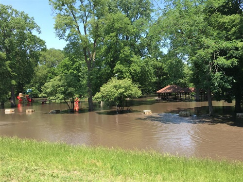
Brookside Park, June 15, 2018
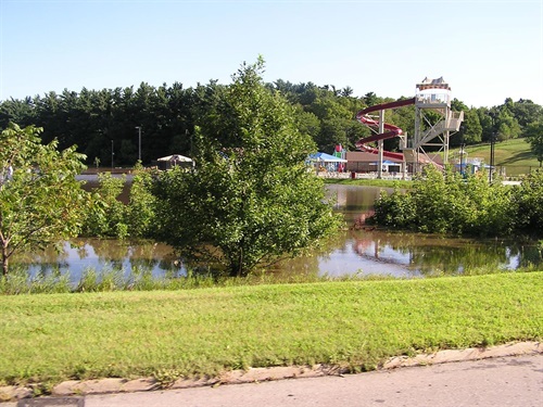
Furman Aquatic Center, 2010
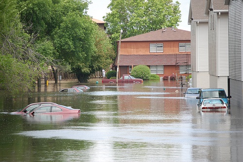
Apartments on South 5th Street, 2008
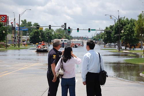
South Duff Avenue, 2008
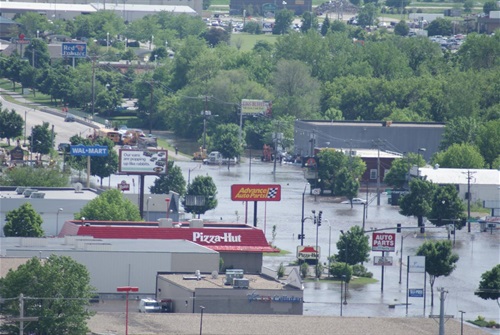
South Duff Avenue, 2008