Flood Plain Development


The City of Ames participates in the National Flood Insurance Program. This program allows all property owners in the City to obtain flood hazard insurance for their structures and contents. In some instances, the purchase of flood insurance may be mandated by your mortgage lender.
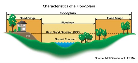
The Special Flood Hazard Area is determined by the Federal Emergency Management Agency following a hydraulic and hydrologic study of the community with its maps adopted by the City Council as the City’s Flood Plain Map. The map identifies the areas in which there is a one percent chance of a flooding event in any given year (also known as the 100-year flood).
Chapter 9 of the Ames Municipal Code. Any excavating, filling, grading, construction of new structures, or remodeling of existing buildings requires submittal of a (PDF, 235KB)Flood Plain Development Permit Application(PDF, 194KB). In general, allowed activities within the Floodway are severely restricted. Activities within the Floodway Fringe may be allowed if they meet certain performance standards. These standards usually involve elevating or floodproofing a structure.
Flood Plain Index Maps
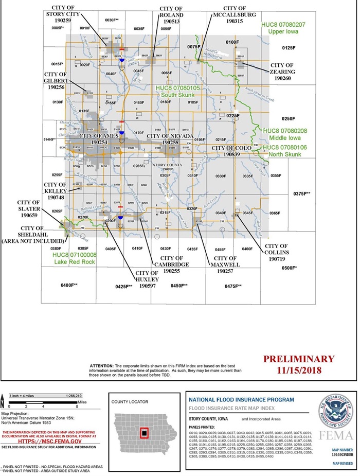
Below is a list of individual FIRM Index Maps updated for the City of Ames. You can find which FIRM Index Panel your property lies in from the links below or through a search by property address here.
| 19169C0135F(PDF, 9MB) |
19169C0137G(PDF, 7MB) |
19169C0139G(PDF, 7MB) |
19169C0141F(PDF, 9MB) |
19169C0142F(PDF, 8MB) |
19169C0143G(PDF, 9MB) |
| 19169C0144G(PDF, 9MB) |
19169C0161F(PDF, 8MB) |
19169C0162F(PDF, 7MB) |
19169C0163G(PDF, 8MB) |
19169C0164F(PDF, 8MB) |
19169C0168F(PDF, 7MB) |
| 19169C0170F(PDF, 8MB) |
19169C0255F(PDF, 8MB) |
19169C0256G(PDF, 8MB) |
19169C0257G(PDF, 7MB) |
19169C0276F(PDF, 7MB) |
19169C0277F(PDF, 7MB) |
A larger image of the FIRM Index Panel can be found at the link here.

Please contact Justin Moore with questions regarding the Flood Plain at justin.moore@cityofames.org.